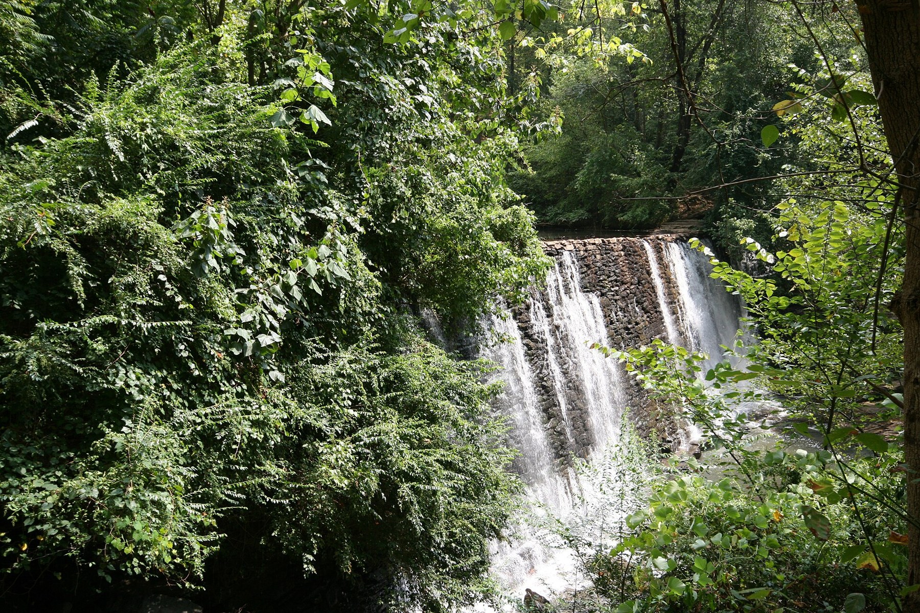
Waterfall at Roswell Mill on Vickery Creek (2007-08-26 14:36)

Outdoors

Fishing near Roswell

Lakes, rivers and recreation areas near Roswell where fishing is allowed, closest first.

25places to fish
5 mito the closest
13within 30 miles

Good to know: Anyone 16 or older generally needs a state fishing license; seasons, limits and special rules vary by water. Georgia license information ↗

Closest picks

1

Chattahoochee River National Recreation Area

5 mi southeast · National Park Service

Today the river valley attracts us for so many reasons. Take a solitary walk to enjoy nature’s display, raft leisurely through the rocky shoals with friends, fish the misty waters as the sun comes up, or have a picnic on a Sunday…

2

Payne Campground-Allatoona Lake

14 mi northwest · US Army Corps of Engineers

Payne Campground sits on the banks of Allatoona Lake, providing visitors with a variety of water activities in the green rolling hills of Georgia.

3

Sweetwater Campground

17 mi northwest · US Army Corps of Engineers

Sweetwater Campground sits on the banks of Allatoona Lake, providing visitors with a variety of water activities in the green rolling hills of Georgia.

Map of all 25 places

Map of 25 places loads as you scroll.

Within 30 miles (13)

5 mi southeast · National Park Service

Chattahoochee River National Recreation Area

Today the river valley attracts us for so many reasons. Take a solitary walk to enjoy nature’s display, raft leisurely through the rocky shoals with friends, fish the misty waters as the sun comes up, or have a picnic on a Sunday…

  • Biking
  • Boating
  • Fishing
  • Paddling
  • Wildlife viewing

14 mi northwest · US Army Corps of Engineers · Campground

Payne Campground-Allatoona Lake

Payne Campground sits on the banks of Allatoona Lake, providing visitors with a variety of water activities in the green rolling hills of Georgia.

  • Camping
  • Fishing
  • Swimming
  • Wildlife viewing

17 mi northwest · US Army Corps of Engineers · Campground

Sweetwater Campground

Sweetwater Campground sits on the banks of Allatoona Lake, providing visitors with a variety of water activities in the green rolling hills of Georgia.

  • Camping
  • Fishing
  • Swimming

17 mi northwest · US Army Corps of Engineers · Campground

Victoria Campground

Victoria Campground sits on the banks of Allatoona Lake, providing visitors with a variety of water activities in the green rolling hills of Georgia.

  • Camping
  • Fishing
  • Swimming

18 mi west · US Army Corps of Engineers · Campground

Galt'S Ferry Day Use Area (Ga)

Galt's Ferry Day Use Area is situated on Allatoona Lake on the Etowah River, a tributary of the Coosa River. The serene lake and peaceful surroundings offer a relaxing getaway from the nearby city of Atlanta, just 35 miles south.

  • Boating
  • Camping
  • Canoeing
  • Fishing
  • Kayaking
  • Picnicking
  • Sailing
  • Swimming

18 mi northeast · US Army Corps of Engineers

Lake Sidney Lanier

Nestled in the foothills of the Georgia Blue Ridge Mountains lies Lake Sidney Lanier, one of America?s favorite lakes. Over 7.5 million people a year choose to visit Lanier.

  • Biking
  • Boating
  • Camping
  • Fishing
  • Hiking
  • Horseback riding
  • Hotel/Lodge/Resort Privately Owned
  • Nature education

18 mi northeast · US Army Corps of Engineers · Campground

Sawnee

Sawnee Campground lies just north of the Buford Dam on Lake Sidney Lanier. The campground features beautiful views of the lake as well as excellent access to boating and swimming.

  • Boating
  • Camping
  • Fishing
  • Picnicking
  • Swimming
  • Water Access
  • Water Activities

19 mi northeast · US Army Corps of Engineers · Campground

Bald Ridge Creek

Bald Ridge Creek Campground is on Lake Sidney Lanier, popular for its aqua-blue waters and spectacular scenery.

  • Biking
  • Boating
  • Camping
  • Fishing
  • Kayaking
  • Swimming
  • Water Access

23 mi northeast · US Army Corps of Engineers · Campground

Van Pugh South Day Use Facility

Van Pugh South Day Use Facility lies on the banks of Lake Sidney Lanier in the foothills of the Blue Ridge Mountains of Northern Georgia.

  • Boating
  • Camping
  • Fishing
  • Picnicking
  • Water Access
  • Water Activities

24 mi west · US Army Corps of Engineers

Allatoona Lake

Allatoona Lake is one of the most frequently visited U.S. Army Corps of Engineers lakes in the nation.

  • Biking
  • Boating
  • Camping
  • Fishing
  • Hiking
  • History
  • Hotel/Lodge/Resort Privately Owned
  • Nature education

24 mi northwest · US Army Corps of Engineers · Campground

COOPER BRANCH No 2 DAY USE AREA (GA)

Cooper Branch #2 Day Use Area is situated on Allatoona Lake on a portion of the Etowah River, which is a tributary of the Coosa River.

  • Camping
  • Fishing
  • Picnicking

24 mi west · US Army Corps of Engineers · Campground

Cooper'S Furnace Day Use Area (Ga)

Cooper's Furnace Day Use Area is situated on the Etowah River, a tributary of the Coosa River. This Day Use Area is downstream of the dam which impounds Allatoona Lake.

  • Camping
  • Fishing
  • Hiking
  • History
  • Picnicking

26 mi northeast · US Army Corps of Engineers · Campground

Old Federal

Old Federal Campground lies on the eastern banks of Lake Sidney Lanier in Northern Georgia.

  • Biking
  • Boating
  • Camping
  • Fishing
  • Picnicking
  • Swimming
  • Water Access
  • Water Activities

30 to 75 miles (3)

31 mi east · USDA Forest Service

Chattahoochee-Oconee National Forest

  • Biking
  • Boating
  • Camping
  • Fire Lookouts/Cabins Overnight
  • Fishing
  • Hiking
  • Horse Camping
  • Horseback riding

44 mi northwest · US Army Corps of Engineers

Carters Lake

Carters Lake Project is managed by the U.S. Army Corps of Engineers, Mobile District. Carters Lake is one of the most scenic lakes in the Southeast.

  • Biking
  • Boating
  • Camping
  • Fishing
  • Hiking
  • Hotel/Lodge/Resort Privately Owned
  • Picnicking
  • Water sports

75 mi southeast · Fish and Wildlife Service

Piedmont National Wildlife Refuge

Piedmont National Wildlife Refuge was established in 1939 as a "combination wildlife and game-management demonstration area" to demonstrate that wildlife could be restored on worn out, eroded lands. Today, through the efforts of the U.S.

  • Fishing
  • Hiking
  • Hunting
  • Photography
  • Ranger programs
  • Wildlife viewing

75 miles and farther (9)

77 mi west · National Park Service

Little River Canyon National Preserve

Little River is unique because it flows for most of its length atop Lookout Mountain in northeast Alabama.

  • Biking
  • Climbing
  • Fishing
  • Hiking
  • Horseback riding
  • Hunting
  • Paddling
  • Picnicking

84 mi north · USDA Forest Service

Cherokee National Forest

  • Biking
  • Boating
  • Camping
  • Fire Lookouts/Cabins Overnight
  • Fishing
  • Hiking
  • Horse Camping
  • Horseback riding

87 mi east · US Army Corps of Engineers

Hartwell Lake

Hartwell Lake is one of the most popular Corps lakes in the nation. Built by the U.S.

  • Boating
  • Camping
  • Fishing
  • Hiking
  • Hotel/Lodge/Resort Privately Owned
  • Nature education
  • Picnicking
  • Water sports

91 mi southwest · US Army Corps of Engineers

West Point Lake

Fishing is probably the most popular activity on West Point Lake. A dozen creeks and more than 40 square miles of lake provide plenty of good fishing spots for the thousands of anglers who fish here regularly.

  • Boating
  • Camping
  • Fishing
  • Hiking
  • Horseback riding
  • Hotel/Lodge/Resort Privately Owned
  • Nature education
  • Picnicking

94 mi southeast · National Park Service

Ocmulgee Mounds National Historical Park

to Ocmulgee Mounds National Historical Park. This park is a prehistoric American Indian site, where many different American Indian cultures occupied this land for thousands of years.

  • Biking
  • Fishing
  • Picnicking
  • Wildlife viewing

100 mi southeast · Fish and Wildlife Service

Bond Swamp National Wildlife Refuge

Bond Swamp National Wildlife Refuge is the result of cooperative conservation efforts of the U.S. Fish and Wildlife Service and The Nature Conservancy.

  • Fishing
  • Hunting

102 mi east · US Army Corps of Engineers

Richard B. Russell Lake

"Ole Dan Tucker was a grand ole man; He washed his face in a fryin' pan; Combed his hair with a wagon wheel; Died with a tooth ache in his heel!" During the 1700's, this famous folk song was sung by slaves in praise of the Reverend Dan…

  • Boating
  • Camping
  • Fishing
  • Hiking
  • History
  • Horseback riding
  • Hotel/Lodge/Resort Privately Owned
  • Nature education

118 mi northeast · National Park Service

Great Smoky Mountains National Park

Ridge upon ridge of forest straddles the border between North Carolina and Tennessee in Great Smoky Mountains National Park.

  • Biking
  • Camping
  • Fishing
  • Hiking
  • History
  • Horse Camping
  • Horseback riding
  • Picnicking

126 mi east · US Army Corps of Engineers

J. Strom Thurmond Lake

Thurmond Lake is the largest Corps of Engineers lake east of the Mississippi River. The lake encompasses 1,200 miles of shoreline, 70,000 acres of water and 80,000 acres of land.

  • Biking
  • Boating
  • Camping
  • Fishing
  • Hiking
  • Horseback riding
  • Hotel/Lodge/Resort Privately Owned
  • Nature education

Distances are straight-line miles from downtown Roswell. Listings come from Recreation.gov’s federal recreation database; check each official page for hours, fees, fire restrictions and closures before you go.

Get outside around Roswell

Driving Roswell Georgia See Why This Atlanta Suburb is So Popular video thumbnail

A DRIVE AROUND TOWN

Driving Roswell Georgia See Why This Atlanta Suburb is So Popular

Driving Roswell Georgia See Why This Atlanta Suburb is So Popular. A film shared by Going 4A Drive.

Watch on YouTube ↗

More outdoors near Roswell

Questions

Where is the closest place for fishing near Roswell?

Chattahoochee River National Recreation Area (National Park Service), about 5 miles southeast of Roswell as the crow flies. Next are Payne Campground-Allatoona Lake (14 mi) and Sweetwater Campground (17 mi).

Do I need a fishing license near Roswell?

Yes, anglers 16 and older generally need a Georgia fishing license from the state wildlife agency. Rules, seasons and limits vary by water.

Who manages these places?

Federal agencies including US Army Corps of Engineers, National Park Service, USDA Forest Service. Each listing links to its official page for hours, fees, closures and current conditions.

Roswell AI

Your Roswell local guide
Hey there!

I'm Roswell AI. Ask about neighborhood food, independent shops, local history or planning a visit.

AI recommendations may be inaccurate. Verify hours and prices. Questions are processed by Cloudflare. Privacy